Course project for CIV550 (Water Resources Engineering) at the University of Toronto. The site survey was on 28 September 2026 and the model was run in November 2026.
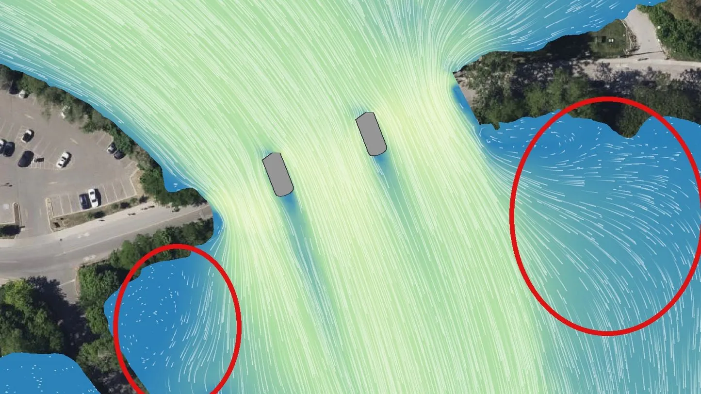
Velocity and particle traces at the Old Mill Road bridge in the 100-year flood at 06:00, with the full shallow water equations (SWE-ELM). The red ellipses mark the two bays below the bridge. This crop has no colour scale. The aerial background is Bing Satellite imagery as shown in HEC-RAS RAS Mapper.
A 2D HEC-RAS model of 2.1 km of the lower Humber River in Toronto, testing how flood size, the equation set and valley roughness change the water levels at three bridges.
With the full shallow water equations the water levels at the bridges rise by 0.04 to 0.05 m, and the velocity under the Old Mill arches falls from 2.24 m/s to 1.57 m/s. Slow wakes form behind the piers and the water recirculates in the side bays. The run takes 4.8 times longer than the run with the diffusion wave.
Plans of the model. SWE-ELM is the full shallow water equations.
Plan
Peak inflow (m³/s)
Manning’s n
Equation set
Normal day
3.15
0.065
Diffusion wave
2-year flood
122.4
0.065
Diffusion wave
100-year flood
475.7
0.065
Diffusion wave
Future 100-year flood
590
0.065
Diffusion wave
Regional flood (Hurricane Hazel)
1702.1
0.065
Diffusion wave
Full momentum
475.7
0.065
SWE-ELM
Rougher valley
475.7
0.078
Diffusion wave
Smoother valley
475.7
0.052
Diffusion wave
The mesh has 213,349 cells of 5 m, refined to 1 m at the banks and 2 m at the 11 piers.
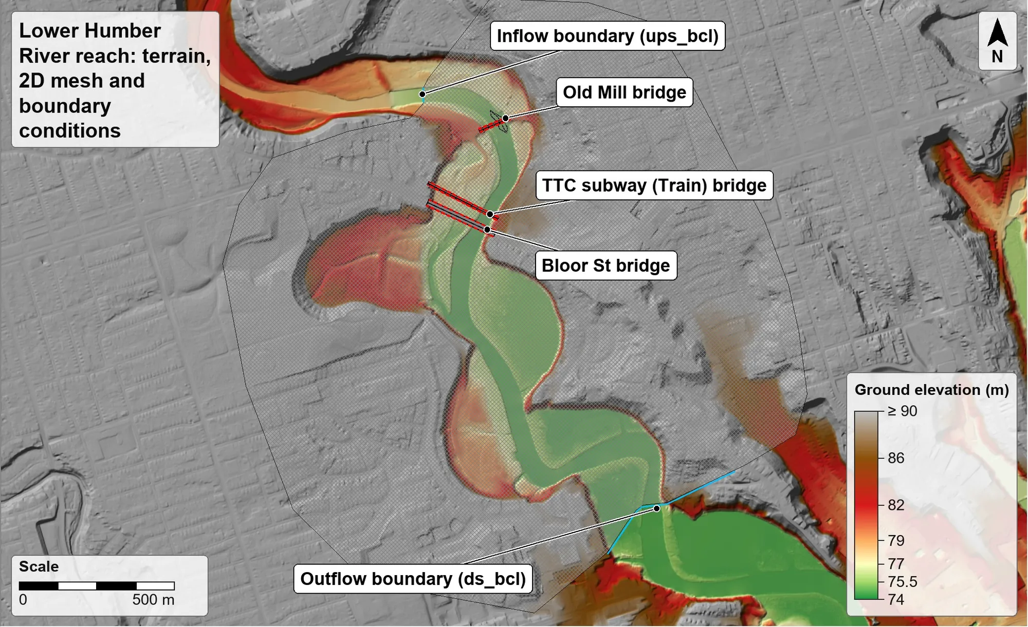
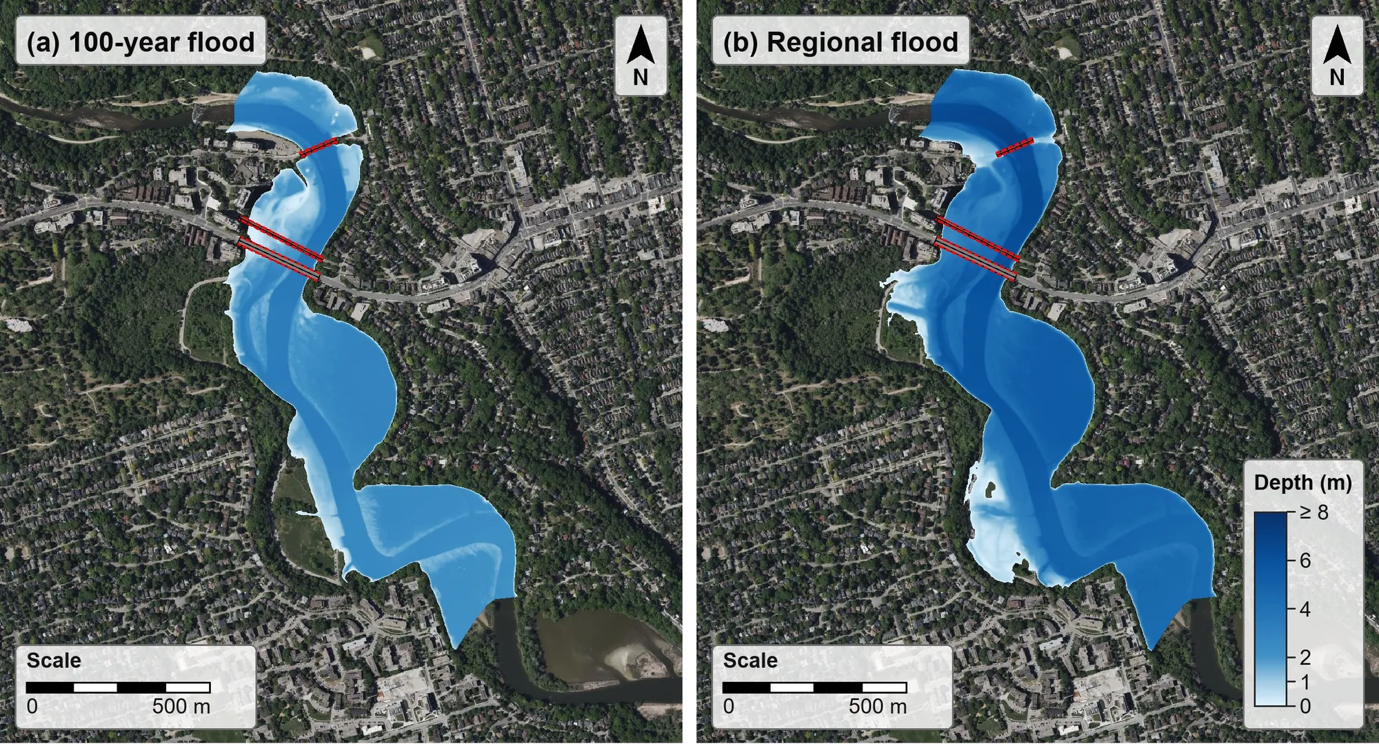
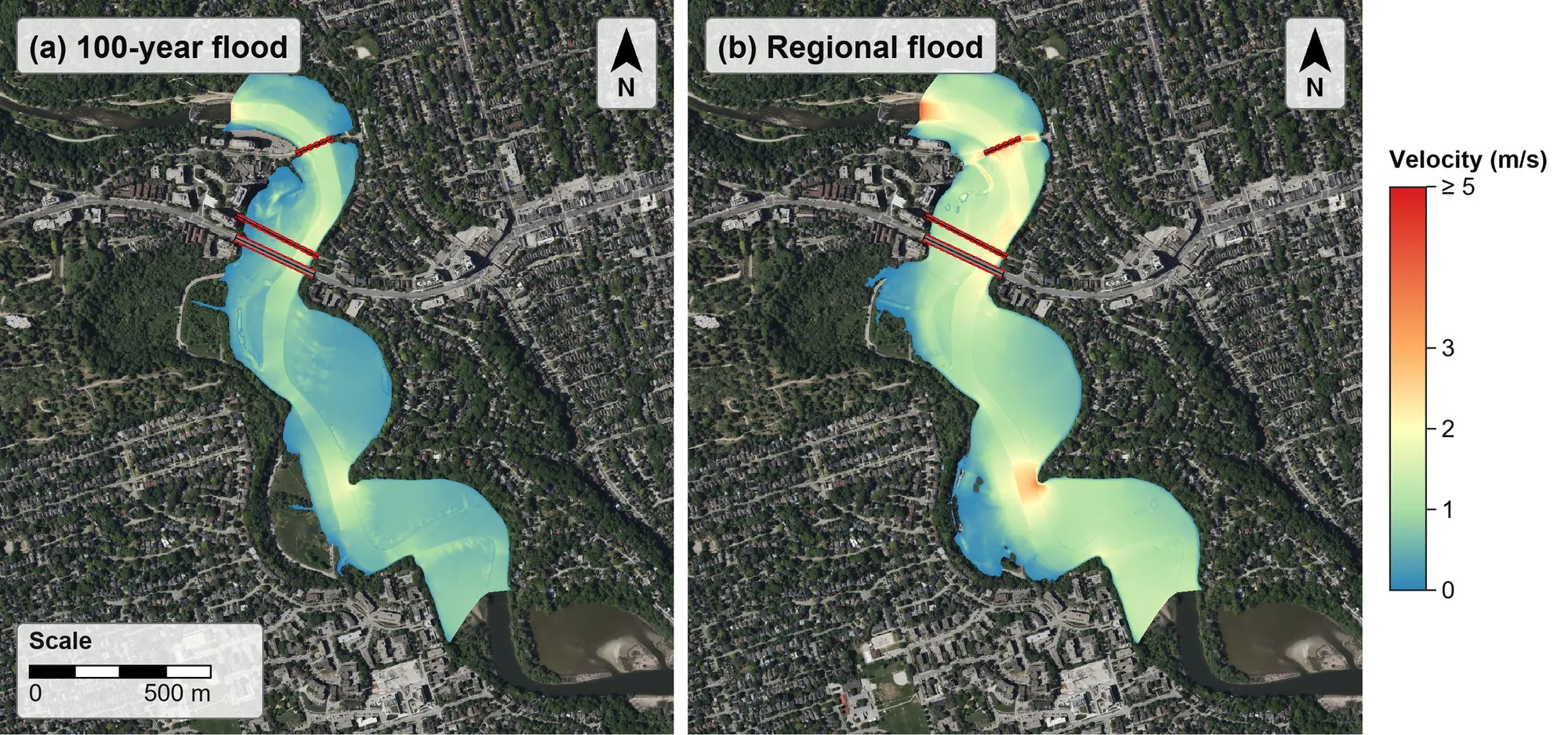
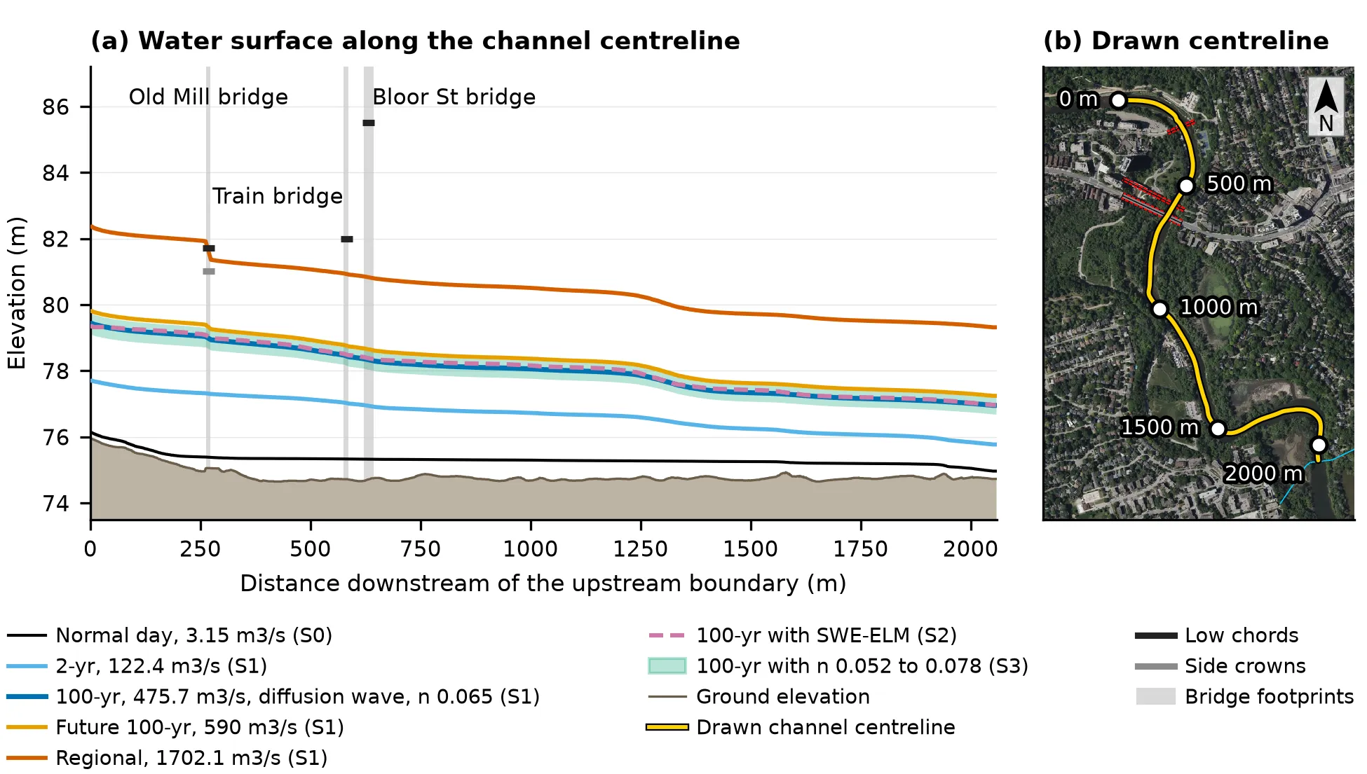
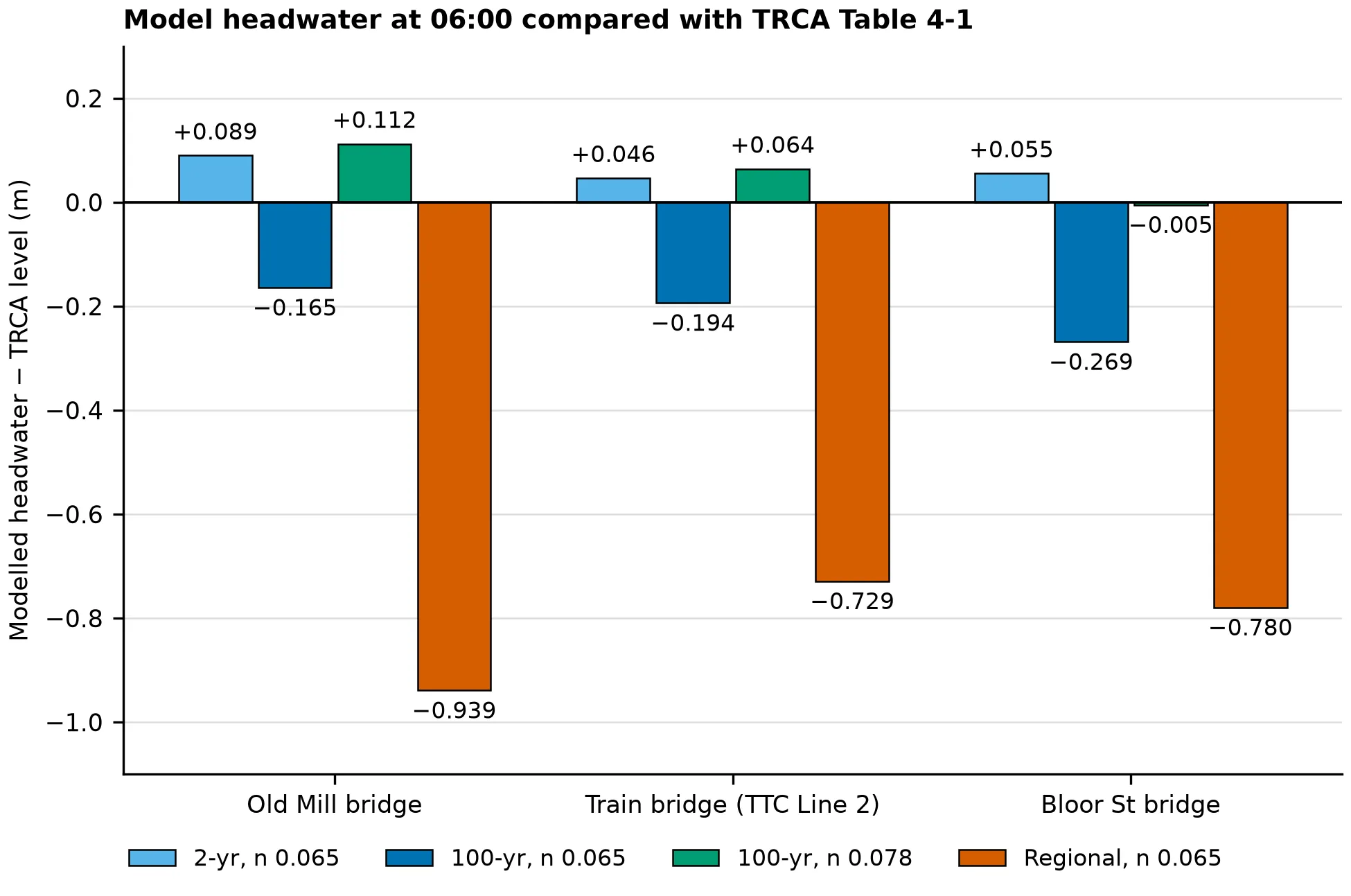
Ground elevation (m, CGVD2013) of the 2,081 m reach, with the 2D mesh (213,349 cells), the three bridges and the inflow and outflow boundary lines.Flow depth (m) at 03:00 in (a) the 100-yr flood (475.7 m3/s) and (b) the Regional flood (1702.1 m3/s). The aerial background is Bing Satellite imagery as shown in HEC-RAS RAS Mapper.Maximum velocity (m/s) from 00:00 to 06:00 in (a) the 100-yr flood and (b) the Regional flood; the red cells at the inflow line in (b) are a boundary effect. The aerial background is Bing Satellite imagery as shown in HEC-RAS RAS Mapper.(a) Water surface along the channel centreline at the end of each run, with the ground, the bridge low chords and the S3 roughness band; (b) the centreline on an aerial image. The aerial background is Bing Satellite imagery as shown in HEC-RAS RAS Mapper.Model headwater at 06:00 minus TRCA's 1D model level upstream of each bridge, for the 2-yr, 100-yr and Regional floods (n 0.065) and the 100-yr flood with n 0.078.
The 2-year, 100-year and Regional flows are from Civica (2018), and the structure data are from the Toronto and Region Conservation Authority (TRCA, 2018). The terrain is the Ontario lidar digital terrain model (package GTA2023-DTM-05), used under Ontario’s Open Government Licence. This is a course project and not a regulatory flood study.